Kartoza - My experience at the EMP Joint Global Training School 2024
I co-facilitated a geospatial data management session at the Energy Modelling Platform's 2024 training school, helping participants from emerging economies tackle energy access challenges.

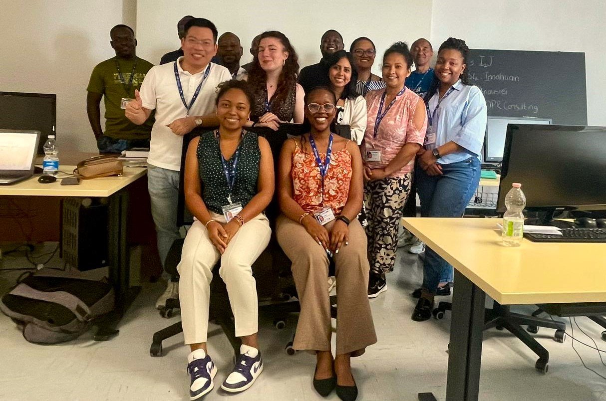
Thanks to a partnership between Kartoza and Sustainable Energy for All (SEforALL), I co-facilitated a geospatial data management training session with my colleague, Seabilwe Tilodi. This training was part of the Energy Modelling Platform's Joint Global Training School 2024, held at ICTP in Trieste, Italy (the photo above was taken from the ICTP). The programme addressed challenges in energy access planning for emerging economies, focusing on the critical role of accurate and accessible data.
One of the reasons I was invited to co-facilitate was that several of the participants were French-speaking. I provided support to ensure they could fully engage with the content. It added an extra layer of collaboration and communication to the sessions, further enhancing the inclusive atmosphere of the training.
Energy Modelling Platform's Joint Global Training School 2024
The summer school included several tracks focused on energy access modelling, each highlighting the essential role of data in energy system planning. Some of the main tracks included:
- EBS & MAED (Energy Balance and Model for Analysis of Energy Demand)
- OSeMOSYS (Open Source Energy Modelling System)
- CLEWs (Climate, Land, Energy, and Water Strategies)
- OnSSET (Open Source Spatial Electrification Tool)
- FinPlan (Financial Planning for Energy Systems)
- OnStove (Open source tool for stove electrification planning)
- EAE (Energy Access Explorer)
- Geospatial Data Management
Each track depended on accurate, up-to-date information on energy needs, resources and infrastructure, yet accessing such data can be a significant challenge in developing nations.

We focused on the Geospatial Data Management track, where we trained participants to organise, govern and utilise geospatial data effectively. Managing geospatial data is vital for understanding and tackling energy access challenges, particularly for emerging economies. Whether planning access to rural communities, optimising energy infrastructure, or mapping renewable energy potential, the ability to work with geospatial data equips participants to make better, more informed decisions.

For my part, I trained the participants in database design schemas, a crucial component in organising and managing large-scale data projects. Teaching them how to structure their data for scalability, accuracy and efficiency was a rewarding experience. Each country had unique data needs, and witnessing their distinct challenges in implementing data-driven solutions was fascinating.

The two weeks of in-person training were enriching. Participants shared insights about their challenges in their respective countries—data scarcity, accessibility issues, and governance problems were common themes. Together, we worked through practical exercises, designing database schema and tackling real-world problems faced by countries in their energy access projects.
The curriculum we covered included several areas:
- Understanding the basics of GIS
- Data collection quality standards
- Data validation
- Data governance planning
Personal Reflection
Participating in this training was an enriching experience. The diversity of participants—from Madagascar, Mozambique, Malawi, Ghana, Bulgaria, Panama and Rwanda—brought various perspectives to our discussions. Each country faced different challenges, and it was inspiring to see how geospatial data management could play a transformative role in tackling these issues.
Final Remarks
By the end of the training, participants were well-equipped with the knowledge and tools to apply these methods in their energy access projects, enhancing their ability to make informed decisions and contribute to sustainable development goals. This experience also reinforced the value of international collaboration, where shared knowledge and diverse perspectives can lead to meaningful solutions for global challenges.
Faneva Andriamiadantsoa
Faneva is from Madagascar. She graduated with a Masters in Information Technology – Mobiquity, Database and System Integration from the University of Nice Sophia Antipolis in 2017. She had the opportunity to work on the OpenDRI project in Madagascar. Thanks to this project, she could attend training on how to create data on OpenStreetMap, QGIS, InaSAFE, and GeoNode. From this, Faneva became interested in the GIS field. Other than gaining knowledge from this, she has been self-taught using online resources such as OSGeo forums and mailing lists. She then developed a QGIS Plugin while working for a GIS company in Antananarivo, Madagascar. Faneva has been inspired by people she has met during conferences and summits she has attended. She has made a small contribution to the QGIS project. Due to her fluency in French, she has contributed to correcting linguistic errors on Geonode. Faneva is very happy to be a permanent member of the Kartoza Team after the GIS training she conducted as a Contractor to Kartoza, part of her GIS journey. Living in Antananarivo Madagascar, she likes walking in small villages around the city. In her free time, Faneva enjoys reading and also tries to practice yoga and meditation.

No comments yet. Login to start a new discussion Start a new discussion