Kartoza - Agile Project Management for a Geospatial Consultancy
GIS projects face challenges like data complexity, tech changes, and budget limits. Kartoza uses Agile and Scrum to enhance flexibility, collaboration, and efficiency, ensuring better project outcomes
Why Agile Matters in a Geospatial Consultancy
Managing geospatial projects comes with a unique set of challenges that can make project delivery complex and unpredictable. Unlike traditional IT or software projects, GIS projects can involve intensive data collection, rapid technological advancements, and a high dependence on accurate spatial information. Budget constraints and time limitations further complicate the process, as clients often underestimate the resources required to develop high-quality GIS solutions.
At Kartoza, we have embraced Agile project management to navigate these challenges effectively. Agile offers a flexible, iterative approach that allows teams to adapt to changes, collaborate efficiently, and deliver value in incremental stages. One of the most effective Agile frameworks we use is Scrum, which structures projects into short, focused work cycles called sprints. By breaking down large, complex GIS projects into smaller, manageable tasks, we can ensure continuous progress, stakeholder involvement, and high-quality results.
In this blog, we will explore the key challenges faced by geospatial consultancies and how Agile methodologies—particularly Scrum—help overcome them. We will also highlight how Kartoza applies Agile principles to real-world GIS solutions, from QGIS plugin development to spatial decision-making platforms and custom geospatial applications. Whether you are a project manager, GIS professional, or developer, understanding how Agile can transform geospatial project management will help you deliver better results, faster and more efficiently.
The Key Challenges in Geospatial Projects
Geospatial projects are complex by nature, requiring specialized tools, high-quality data, and significant resources. However, several common challenges can hinder project success. These include budget and time constraints, data collection complexities, rapidly evolving technology, and limited awareness of GIS outside the industry. Addressing these challenges requires strategic planning, stakeholder education, and the right project management approach.
1. Budget and Time Constraints
One of the biggest hurdles in GIS projects is managing costs and timelines effectively. Geospatial work is often more resource-intensive than clients anticipate, leading to underestimated budgets and unrealistic deadlines. Without careful planning, projects can quickly exceed their financial and time limitations.
How to Overcome This:
- Clearly define deliverables to set realistic expectations early.
- Develop a minimum viable product (MVP) to provide value without over committing resources.
- Leverage free and open-source software (FOSS) to reduce licensing costs and make projects more cost-effective.
2. Data Collection Complexities
GIS projects rely on accurate, high-quality data—"Quality in equals quality out." Poor data can lead to flawed analyses and unreliable decision-making, making it essential to ensure data integrity from the start.
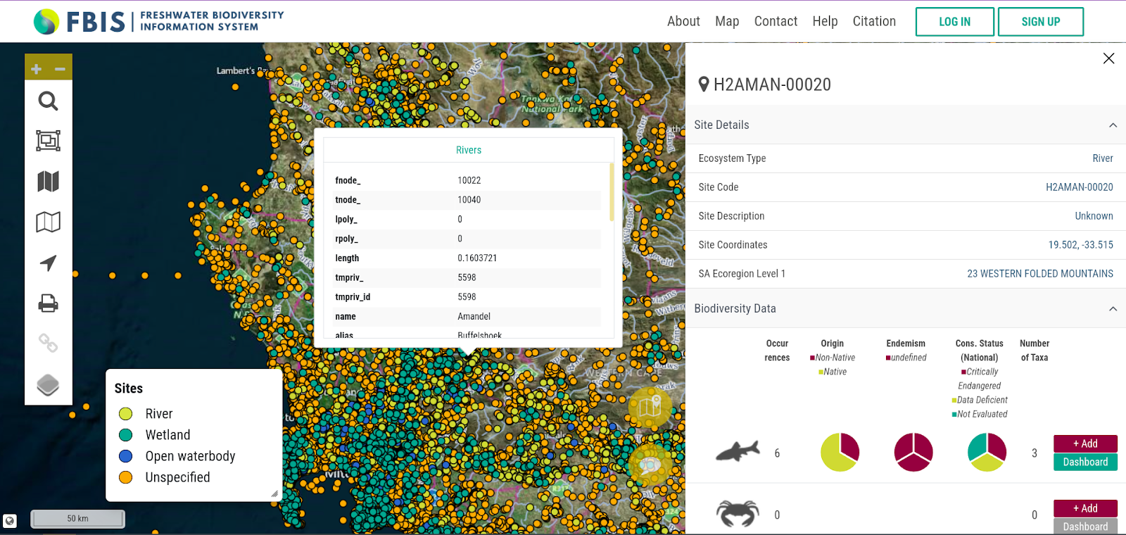
Image of data points in FBIS
How to Overcome This:
- Understand project requirements to ensure data collection aligns with the overall objectives.
- Educate stakeholders on the importance of high-quality data and how it impacts project outcomes.
- Utilise open data sources and advancements in data collection technology to improve efficiency and accuracy.
3. Keeping Up with Rapidly Evolving Technology
GIS tools, platforms, and software are constantly evolving, making it difficult to keep up with the latest developments. New updates and shifting standards can disrupt workflows, forcing teams to continuously adapt.
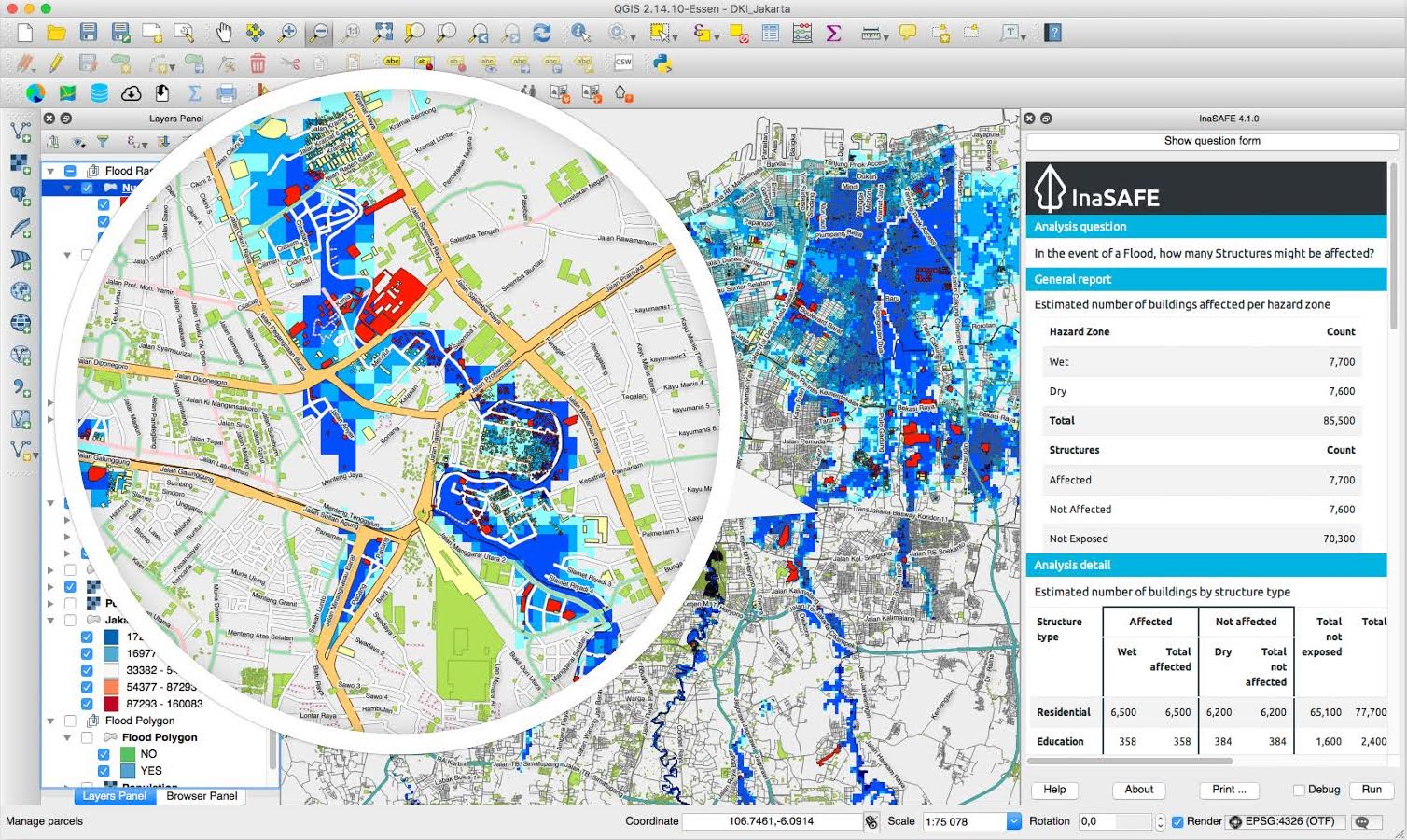
Image of InaSafe viewer
How to Overcome This:
- Establish upfront communication with clients about potential software updates and their impact.
- Implement Service Level Agreements (SLAs) to ensure ongoing support for long-term projects.
- Encourage continuous learning within teams to stay up to date with the latest geospatial technologies.
4. Limited Awareness and Adoption Outside GIS
Despite its growing importance, GIS is still underutilised in many industries. Limited understanding of its benefits can make it challenging to secure buy-in from stakeholders outside the geospatial field.
How to Overcome This:
- Educate other departments on how GIS can improve decision-making and efficiency.
- Use storytelling with data to make geospatial insights more accessible and relatable.
- Showcase success stories and return on investment (ROI) to demonstrate the tangible value of GIS solutions.
By understanding these challenges and proactively addressing them, geospatial consultancies can improve project success rates and deliver more impactful solutions. Adopting a strategic, flexible approach to project management is key to overcoming these obstacles and ensuring long-term success in the GIS industry.
The Agile Advantage in Kartoza Projects
To effectively manage the complexities of geospatial projects, Kartoza has adopted Agile project management, a flexible and iterative approach that emphasizes collaboration, adaptability, and continuous value delivery. Agile allows teams to break projects into smaller, manageable tasks, ensuring steady progress while remaining responsive to changes and stakeholder needs.
One of the key frameworks we use is Scrum, which structures projects into short, focused work cycles called sprints. Scrum helps teams stay organized, improve efficiency, and maintain clear communication throughout the project life cycle.
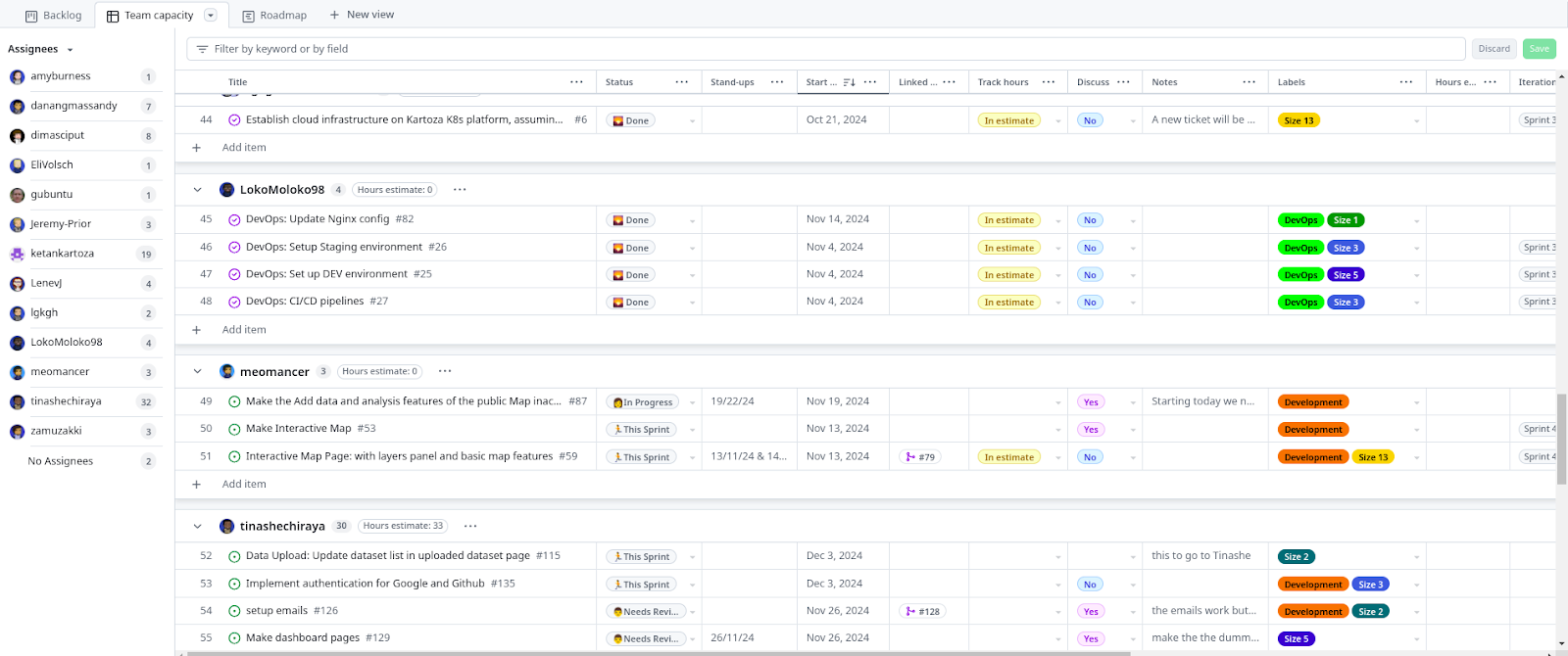
Image of GitHub Task Tracking Table View
How Scrum Works
Scrum is built around three key components:
- Artefacts: The product backlog, sprint backlog, and increment, which help track tasks and deliverables.
- Events: Regular sprint cycles, including sprint planning, daily stand-ups, sprint reviews, and retrospectives, which keep projects on track.
- Roles: A defined team structure that includes the Product Owner, Developers, and Scrum Master, ensuring accountability and streamlined decision-making.
By implementing Scrum, Kartoza ensures that geospatial projects are delivered efficiently, with a focus on continuous improvement and stakeholder engagement. Agile methodologies enable our teams to adapt quickly to evolving project requirements, optimise workflows, and consistently deliver high-quality solutions.
Conclusion: The Power of Agile in Geospatial Project Management
Geospatial projects are inherently complex, requiring precise data management, adaptable workflows, and collaboration across multiple disciplines. Challenges such as budget constraints, evolving technology, and limited awareness outside the GIS industry can make project execution difficult. However, by adopting a structured yet flexible approach like Agile project management, geospatial consultancies can navigate these challenges more effectively.
At Kartoza, Agile methodologies—particularly the Scrum framework—have transformed the way we manage projects. By breaking down large, complex tasks into manageable sprints, teams can ensure steady progress while remaining responsive to client needs. With well-defined artefacts to track deliverables, structured events to maintain alignment, and clear roles to ensure accountability, Scrum provides a proven system for managing GIS projects efficiently.
One of the key benefits of Agile is its emphasis on continuous improvement. Through iterative development, teams can refine workflows, address challenges as they arise, and incorporate feedback to enhance project outcomes. Regular sprint reviews and retrospectives create a culture of learning, allowing teams to adapt and optimise their approach for future projects.
Beyond internal efficiencies, Agile also improves stakeholder engagement. Clients and project partners remain actively involved throughout the process, ensuring that expectations are managed and adjustments can be made in real time. This reduces the risk of costly rework and ensures that the final deliverables align closely with project goals.
As geospatial technology continues to evolve, so must the way we manage GIS projects. By leveraging Agile methodologies, geospatial consultancies can increase efficiency, enhance collaboration, and consistently deliver high-quality solutions that meet the demands of a fast-changing industry. For GIS professionals looking to improve their project management approach, adopting Agile is not just an option—it’s a necessity for staying ahead in an increasingly dynamic field.
Michelle von Maltitz
Michelle holds an honours degree in Geographic Information Systems (GIS) and through her experience in the work environment has developed a passion for project management for which she now holds several qualifications. She is an experienced project manager with 10 years of success leading all phases of diverse multi-million-rand projects within the field of GIS and Aerial Survey. She is comfortable trying innovative methods and new techniques in her project management style. Her key strength lies in being focused and disciplined in her work approach, coupled with a result driven approach that boosts propensity for continuously seeking ways to add value and take the initiative in improving processes. When she is not working, you are liking to find her somewhere in the mountains.


No comments yet. Login to start a new discussion Start a new discussion