Kartoza - Year in Review: 2018
It's been another awesome year for our Team. We have come a long way since establishing Kartoza in 2014, building many different software products, making friends
It’s been another awesome year for our Team. We have come a long way since establishing Kartoza in 2014, building many different software products, making friends and working with existing and new clients. Forming a company around an open source friendly business model presents many challenges but is also extremely rewarding. Here is our 2018 year end review that we would like to share with you!
Event Highlights
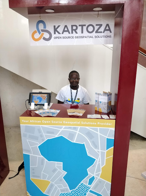
FOSS4G
FOSS4G is the annual conference for Open Source geospatial practitioners and enthusiasts. This year FOSS4G2018 was held in Dar es Salaam, Tanzania. Team Kartoza were there in force. We were Silver Sponsors for the event and were the only sponsoring African open source geospatial solutions company. Tim Sutton was also on the local organising committee. Kartoza was further represented at the event by Gavin Fleming (Kartoza co-founder), Christian Christelis, Admire Nyakudya, Anita Hapsari and Rizky Nugraha. It was a fun-packed week of learning and sharing.
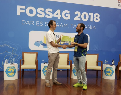
A highlight of the event was the the awarding of Honorary QGIS Project Steering Committee (PSC) Membership to Kartoza co-founder and long time QGIS contributor, Tim Sutton. It was a fun-packed week of learning and sharing.
UR2018
The Understanding Risk (UR) Forum was another milestone event of 2018. This took place in May in Mexico City. Kartoza shared some of the things we learnt using and building open source geospatial solutions for disaster risk reduction (DRR). For the last six years Kartoza has been actively developing tools like InaSAFE to support DRR efforts.. Kartoza was represented at the event by co-founder Gavin Fleming and Ismail Sunni. Read more about this event on our blog article.
QGIS ZA meet-ups
Kartoza is actively involved in the development and support of the local QGIS user community in South Africa. Kartoza team member Admire Nyakudya is also the QGIS Country Representative for the South African user group. We regular present to the user group meet-up. It is really great to see growing interest in the use of QGIS and FOSSGIS in South Africa! Meetings are currently held every few months in Cape Town and Gauteng.
GeoNode Summit
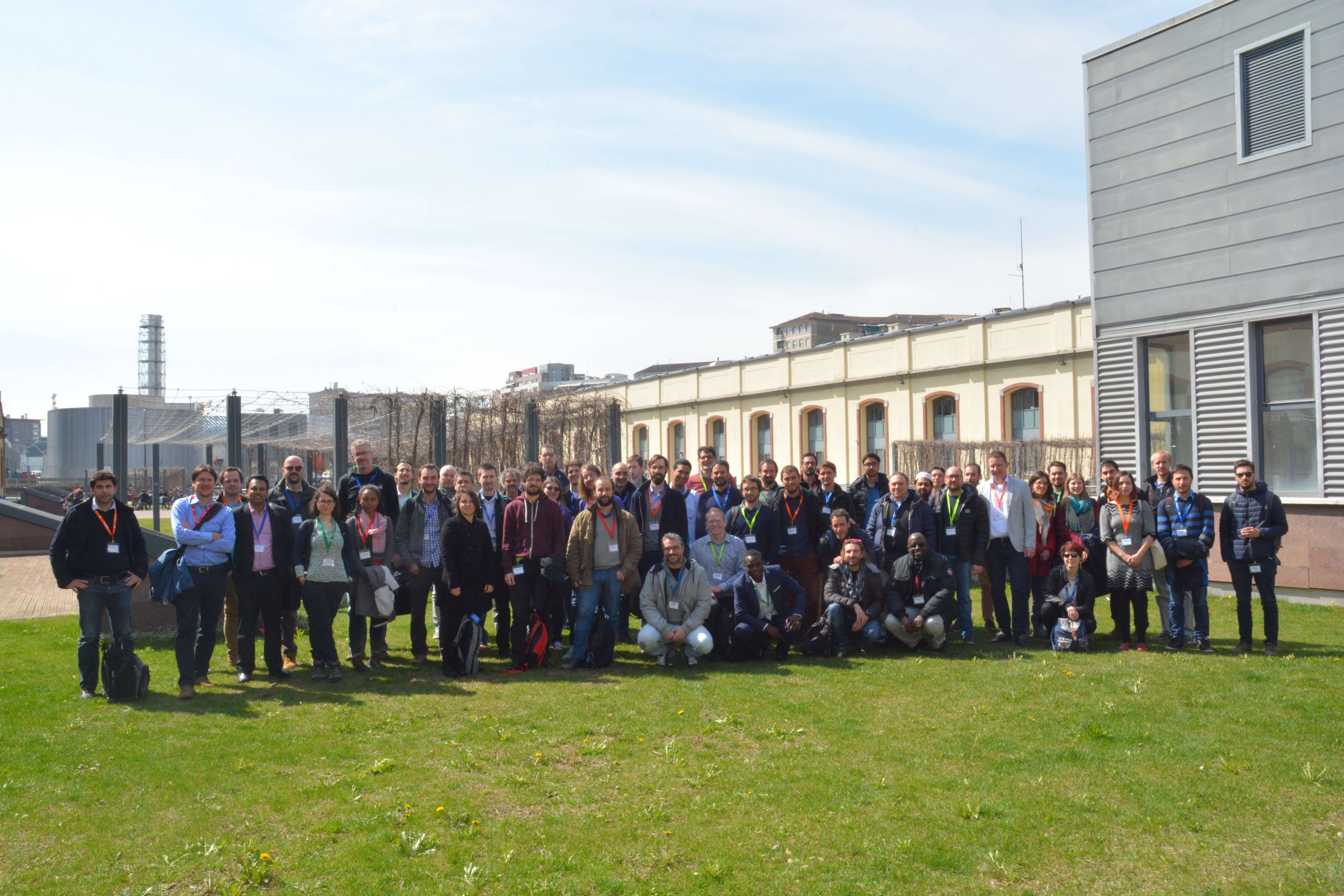
Gavin Fleming represented Kartoza at the GeoNode Summit in Torino, Italy in March. We presented our work on adding the QGIS server backend to GeoNode as a GeoServer replacement and the work we did in core QGIS to add a GeoNode provider, which arrived with QGIS 3.
Here you can see a group photo of all the GeoNode Summit participants.
Geekulcha MediHack
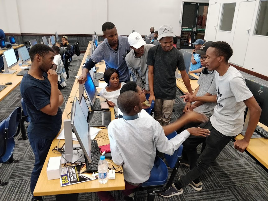
Gavin volunteered at this hackathon at the University of Limpopo in August, where students competed to build apps with free and open health-related data. Many tried to do non-spatial apps like ‘which clinics have stock of the medication I need’ but a couple of groups tried to solve questions like ‘how can an ambulance reach a patient in a deep rural area or informal settlement with few formal roads or addresses?’. Kartoza staff participate in and support events such as this which promote open data and transparency while promoting skills and entrepreneurship.
Key Projects
At Kartoza we feel immensely honoured to have worked with incredible partners to create Open Source Geospatial Solutions for socially uplifting projects. These are some of our project milestones of 2018:
InaSAFE

InaSAFE: 2018 saw the completion of our contract with DFAT / Government of Australia to develop InaSAFE. InaSAFE is a tool to help disaster managers prepare for disasters. It is the culmination of 6 years of engagement of InaSAFE work in Indonesia. During that time we have delivered many versions of InaSAFE Desktop and InaSAFE Realtime (which delivers near real time hazard impact reports). You can find the InaSAFE plugin in the QGIS plugin manager (and thanks to our friends over at North Road consulting, InaSAFE now runs on QGIS 3.x too).
GeoSAFE
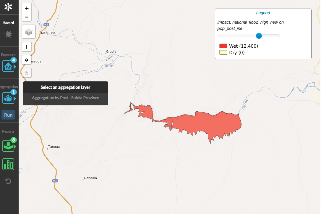
GeoSAFE: With support from the World Bank GFDRR, Kartoza built a web interface to InaSAFE that integrates with GeoNode and uses a headless InaSAFE running on QGIS server to perform InaSAFE analyses and produce reports. We delivered a production instance to the National Disaster Management Agency of Mozambique.
MyFarmWeb
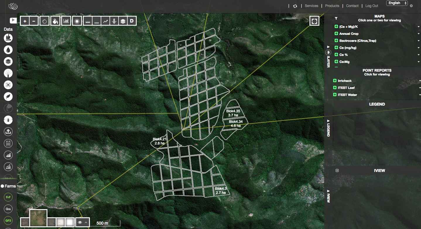
MyFarmWeb: Kartoza continues our successful relationship with AgriTechnovation, ongoing since 2015. At that stage AgriTechnovation were supplying their customers with hardcopy and pdf reports on soils, pests, crop health and other precision farming inputs. They wanted to put these resources online so farmers could access them easily and also see historical analyses in context, with an interactive map of their fields being at the centre of the experience. We built a solution around Django, QGIS server, QGIS desktop, PostGIS and OpenLayers that has helped AgriTechnovation achieve that goal. As usage and performance requirements increased, we moved parts of the system to the cloud (AWS). MyFarmWeb has become a key product for AgriTechnovation, with thousands of users in South Africa and beyond.
The MyFarmWeb app is available only to customers of AgriTechnovation.
BIMS - Limpopo & FBIS
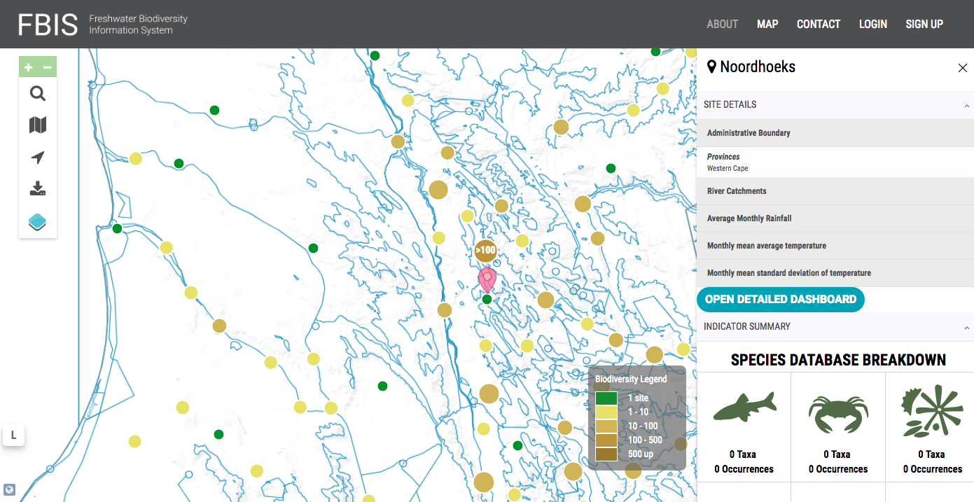
BIMS - Limpopo & FBIS: Through our partnerships with LEDET (the Limpopo Provincial Government Department of Economic Development, Environment and Tourism) and the Freshwater Research Centre we have been working on a new web platform for managing and visualising biodiversity data. We have many plans for new features and improvements to the platform over the course of 2019. Contact us if you are looking for a customised web platform for hosting your biodiversity data! View the FBIS site here.
MapCampaigner
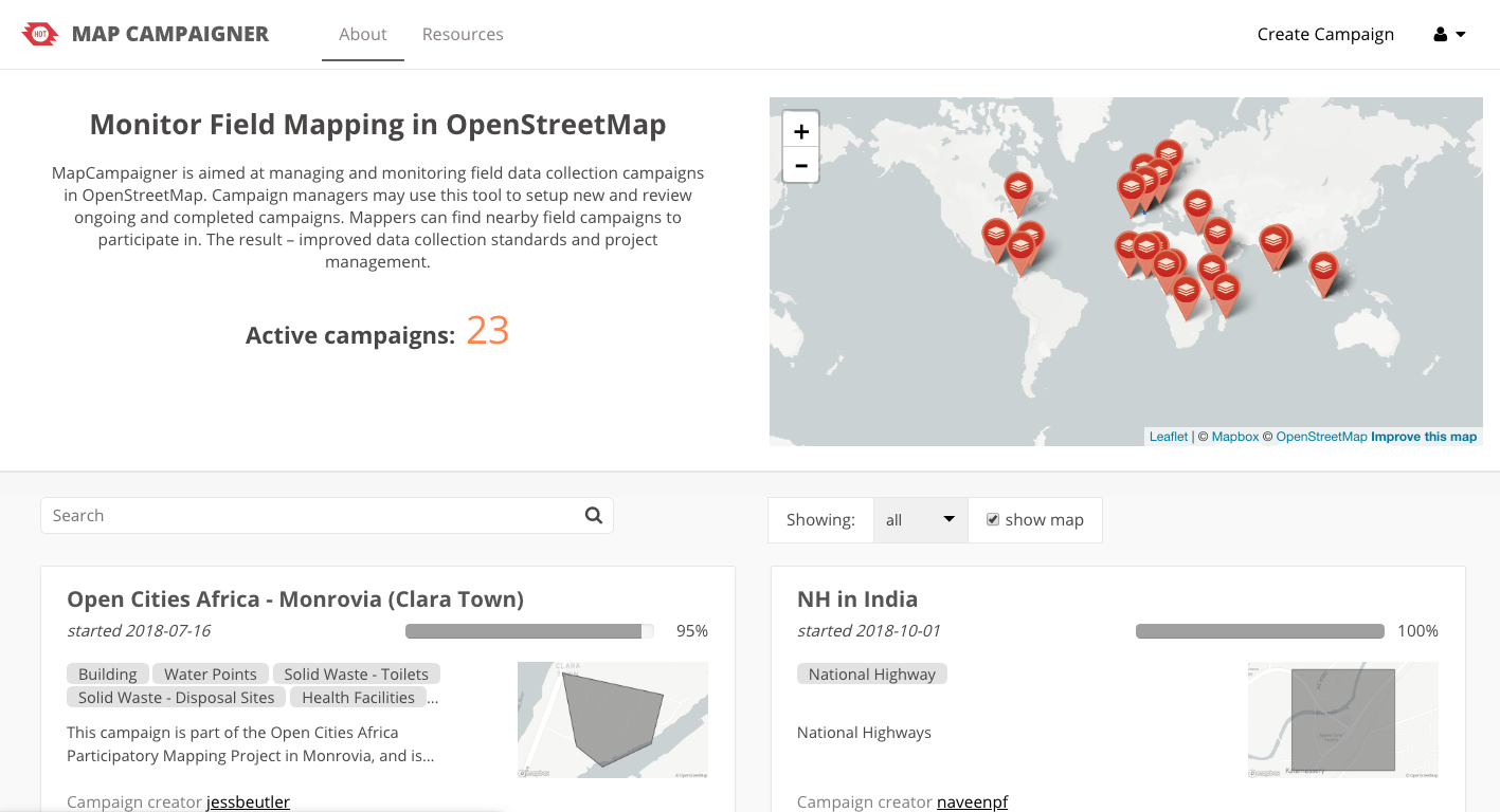
MapCampaigner: We worked with our friends at the Humanitarian OpenStreetmap Team (HOT) to develop a new version of MapCampaigner. “The OSM Campaign Manager project aims to bring field data collectors and campaign managers together on a single platform. Campaign managers are able to set up specific campaign types to evaluate the progress of field campaigns. Remote mapping projects can also be connected to campaigns.”
Cape Town Marathon
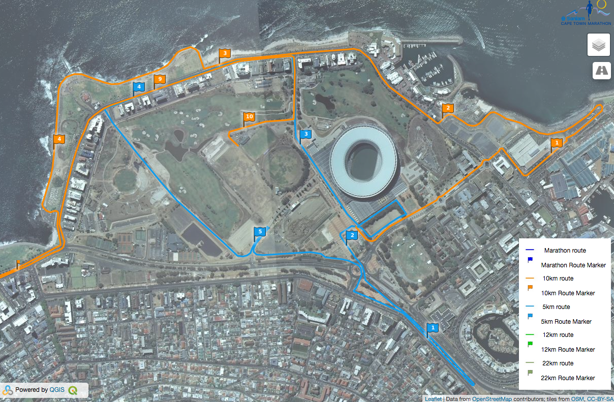
Cape Town Marathon: Kartoza supported the organisers of the Cape Town Marathon (and Cape Town Carnival) to do all their planning in QGIS and PostGIS. Read more about it on our blog articles.
Other News
GIS BOX
We launched GISBOX a few months ago, which is an on-premise, managed open source GIS server packed with ready-to use data. Check out more info on this exciting product here.
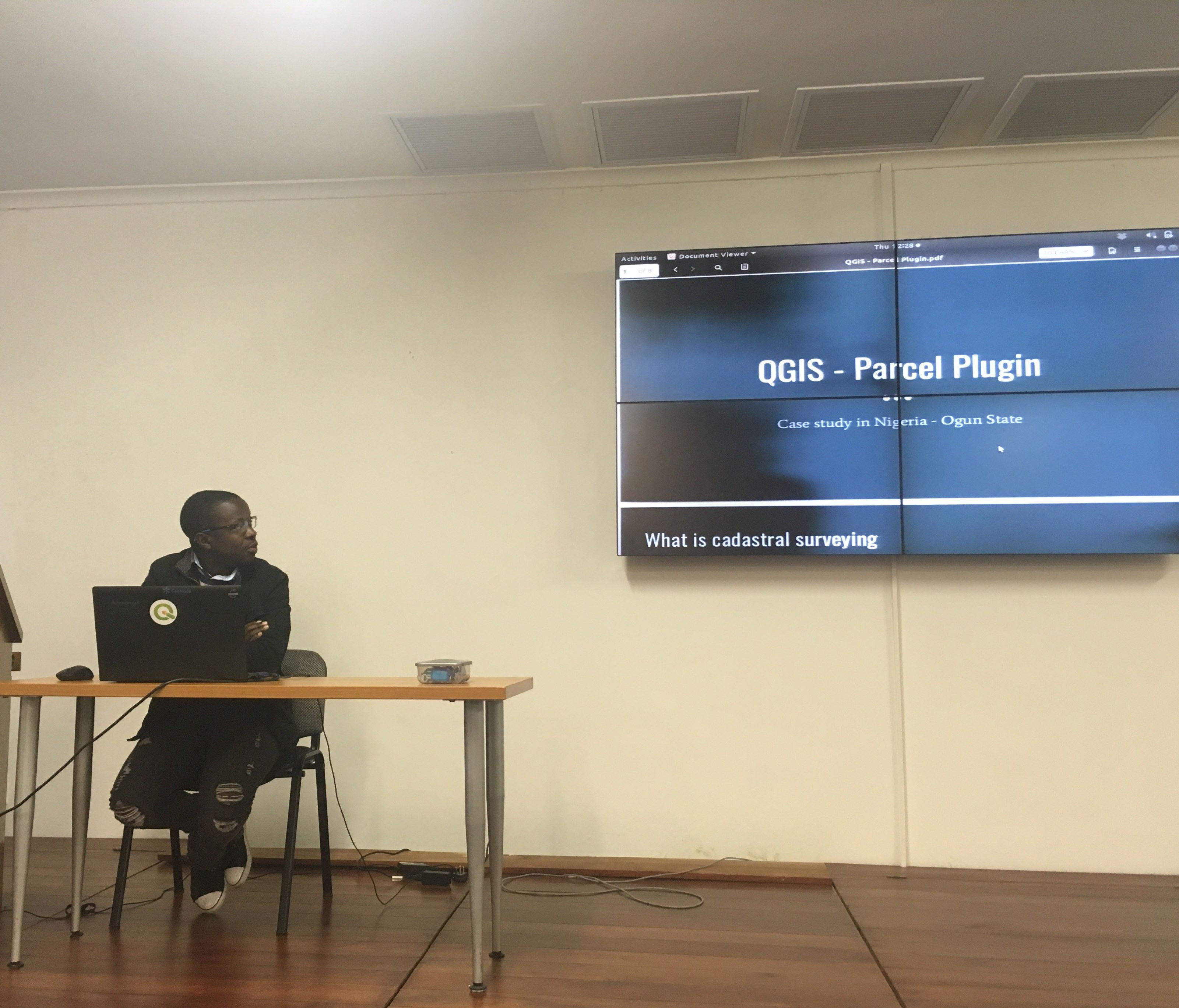
Training Courses
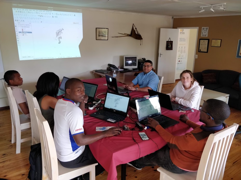
We presented several courses throughout the year covering various FOSS GIS technologies. In the image above, Admire presents a QGIS course at our Johannesburg office. See our upcoming 2019 courses here.
Limosa Open Source GIS Support
We rely on our experience to give you the assurance that there’s always someone to call for help should you need it. Kartoza is the first organisation to our knowledge to provide QGIS and other FOSS GIS commercial support to businesses and individuals across South Africa and the rest of Africa. Our support team has a mix of friendly first- and second-line support staff to ensure an efficient response to support queries. Read more about our support service here.
Contact us for support collaboration in 2019.
Fun, of course
Our team also had a lot of fun along the way in all corners of the world.
Anita’s last day in the Kartoza office in Stellenbosch before she flew back to Java island, Indonesia.
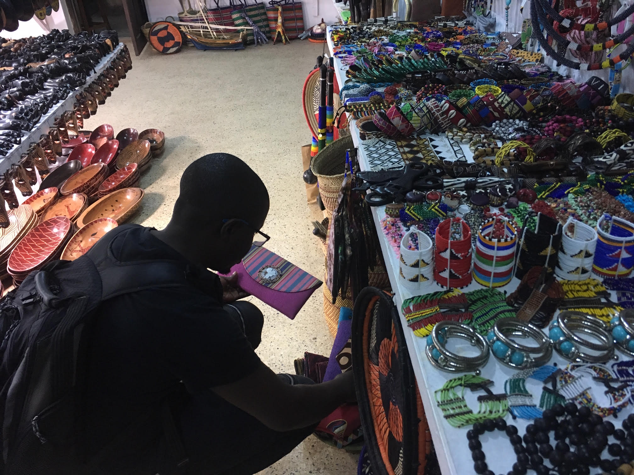
Admire shopping in Zanzibar.
All Hands on Deck meeting with the Team
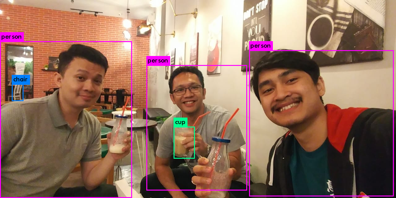
We have been doing R&D using AI to recognise objects in images. Here is a fun example of using Yolo on a picture of some of our team, Dimas, Boney, Rohmat, hanging out at a juice bar in in Surabaya, East Java Island, Indonesia.
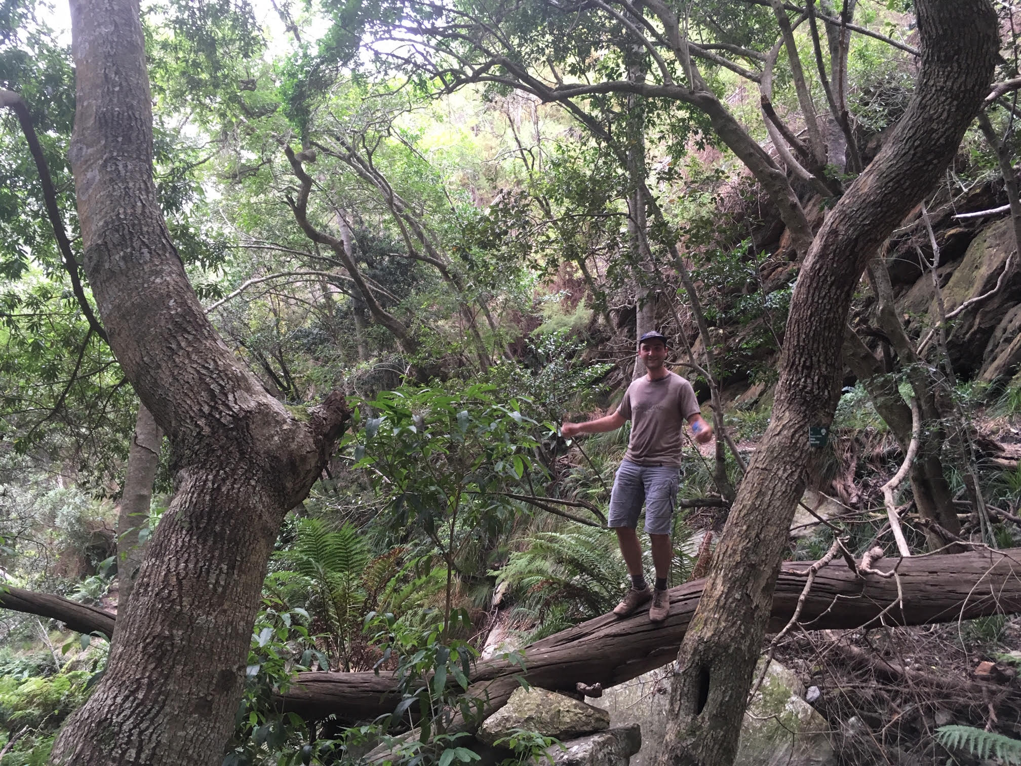
Etienne up the mountain near our Swellendam Office.
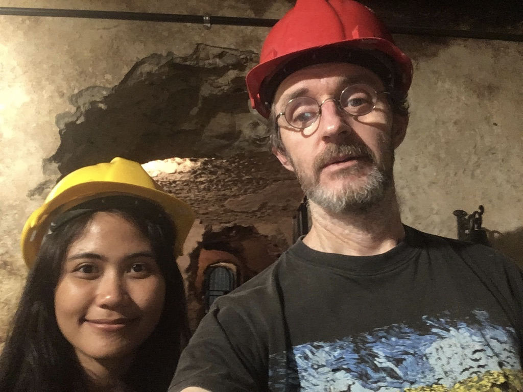
Anita and Tim while visiting a cave near Swellendam.
Thank You
Thank you for being a part of this memorable journey. Please contact us if you want to collaborate with us in the new year. See you in 2019 for bigger and better Open Source Geospatial Solutions.
Seasons Greetings to you all.
With Love,
Kartoza Team


No comments yet. Login to start a new discussion Start a new discussion