BIMS
Biodiversity data, organised and ready for action
The Biodiversity Information Management System (BIMS) is a platform for managing, analysing, and visualising biodiversity data — from field collection to policy insights.
BIMS is an open-access platform for serving, hosting, analysing, visualising, and sharing biodiversity data. It is designed to support data-driven ecosystem management and conservation.
Who is it for?
BIMS is shaped by the needs of water resource managers, biodiversity planners, conservation agencies, researchers, and environmental consultants.
The goal is simple: get high quality biodiversity evidence into real decision-making pipelines.
What kind of data?
Species occurrence and abundance, habitat and abiotic parameters, freshwater taxa (fish, invertebrates, algae, anurans, wetland plants), SASS biomonitoring, physico-chemical parameters, water temperature time series, and more.
Why was it built?
To make biodiversity data usable — not just stored. To improve long-term conservation outcomes and guide real-world freshwater management.
Origins and collaboration
The platform began life as the Freshwater Biodiversity Information System (FBIS) in South Africa. It was developed by the Freshwater Research Centre in partnership with Kartoza and the South African National Biodiversity Institute, with support from the JRS Biodiversity Foundation (2017–2024).
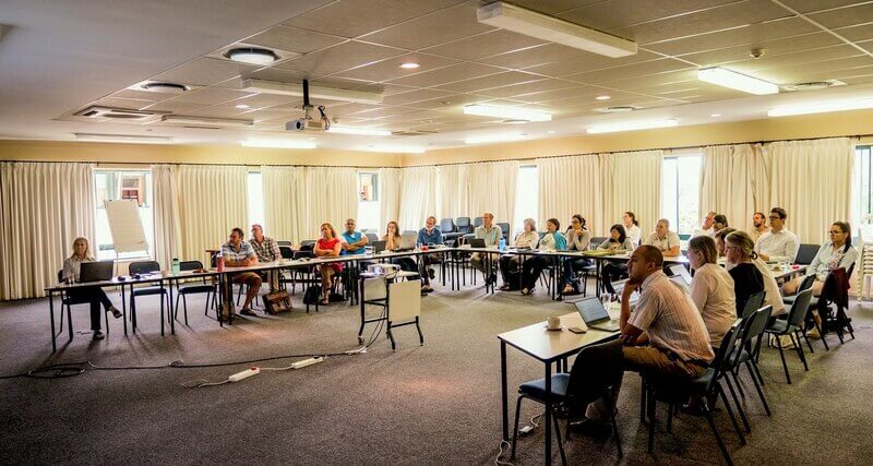 FBIS user requirements workshop at SANBI, 2018
Running BIMS portals
BIMS isn't theoretical — it's live. These instances are already supporting biodiversity management in the field and at government level:
The Freshwater Biodiversity Information System for South Africa. Focused on freshwater biodiversity and biomonitoring.
freshwaterbiodiversity.org ↗Internal biodiversity information system for South Africa’s national parks and marine protected areas. Used by authorised SANParks staff to upload, explore and download occurrence data for conservation and management.
bims.sanparks.org ↗The Rwanda Biodiversity Information System. National biodiversity data and reporting.
rbis.ur.ac.rw ↗Wetlands information system for the Kafue Flats — a Ramsar-listed floodplain critical for biodiversity, hydropower, fisheries and livelihoods in Zambia.
kafue.kartoza.com ↗Open freshwater biodiversity data and decision-support tools for Africa — maps, trends and evidence for conservation and policy.
fbisafrica.org ↗infraFADA curates and publishes expert-reviewed global checklists of freshwater animal diversity (species, genera). These open lists are used as a taxonomic backbone by Catalogue of Life, GBIF, the Freshwater Information Platform and others.
fada.kartoza.com ↗Cross-border federation of freshwater biodiversity datasets. Supports shared evidence for basin-scale decision-making.
fip-bio.igb-berlin.de ↗The Okavango Repository for BiodiverSity Data. Regional biodiversity information aligned with basin management.
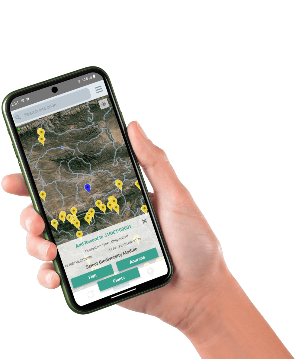
offlineBIMS Mobile App
The BIMS mobile application lets you capture biodiversity data directly in the field — no paper sheets, no spreadsheets.
Add fish, invertebrates, algae, anurans, wetland plants, SASS biomonitoring, site conditions, photos, notes and more. Sync later over Wi-Fi, or send straight from the river using mobile data.
Available for Android.
Open source & collaboration
BIMS is open source. The full platform codebase is developed in the open and maintained collaboratively. The project lives in kartoza/django-bims ↗ on GitHub.
Want to deploy BIMS, connect your biodiversity data, or help improve the platform?


