Kartoza - Some QGIS 3 Browser Improvements - Small Things Matter
Well, QGIS 3 has been out for a couple of weeks now with lots of new functionality.
·
1 min read
Well, QGIS 3 has been out for a couple of weeks now with lots of new functionality. While you are still feeling your way around all the new features I thought I could highlight some of the improvements to the browser panel that will make you fall further in love with QGIS.
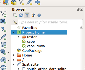
| 1. Ability to load QGIS projects from the browser. We now have a Project Home Menu which will list all your QGIS project for easy loading. You can load the project by just dragging it | onto the map canvas or right click and choose Add Project. |
 | |
| 2. Permanently delete files from the file system using the browser dialog. | 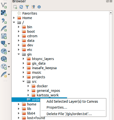 |
| 3. Add XYZ (or ZXY) tile layers into QGIS . Example for South African Topographical maps : https://htonl.dev.openstreetmap.org/ngi-tiles/tiles/50k/{z}/{x}/{-y}.png | 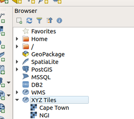 |
| 4. Connect QGIS to a GeoNode Instance running QGIS server backend. | |
| 5. Preview metadata for layers before loading them into QGIS. | 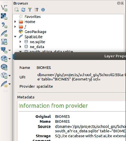 |
| 6. Filter for files in the browser dialog. This facilitates easy searching and loading of layers into QGIS. The search can be based on plain text, wildcards or regular expressions. | 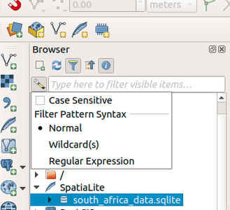 |
| 7. The browser is now able to detect Python scripts, which you can run directly. | 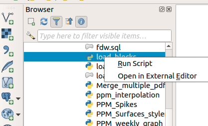 |
These changes might be small but they all improve the user interactions in QGIS. In the next article, we will look at how to connect to a GeoNode instance.


No comments yet. Login to start a new discussion Start a new discussion