Kartoza - How to Easily Add South African and Namibian Toposheets as XYZ Tiles to QGIS
Thanks to the great work of Grant Slater and the OpenStreetmap team, there are freely available XYZ tilesets for South Africa and Namibia 1:50 000 series toposheets
Thanks to the great work of Grant Slater and the OpenStreetmap team, there are freely available XYZ tilesets for South Africa and Namibia 1:50 000 series toposheets which can easily be added to QGIS. Here is the general procedure to add a layer:
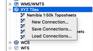
1.) Open the browser panel (View -> Panels -> Browser) and scroll down to the entry called XYZ tiles if needed.
2. ) Right-click the XYZ tiles entry and choose 'New Connection...'
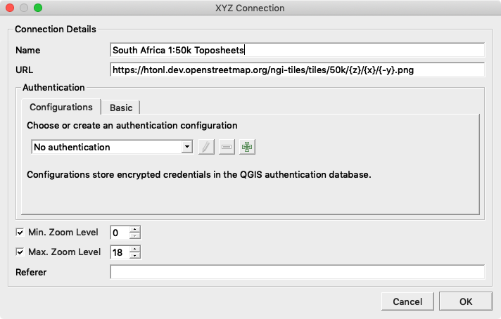
3.) Enter the connection details (see the bottom of this post for the SA and Namibia connection URLS
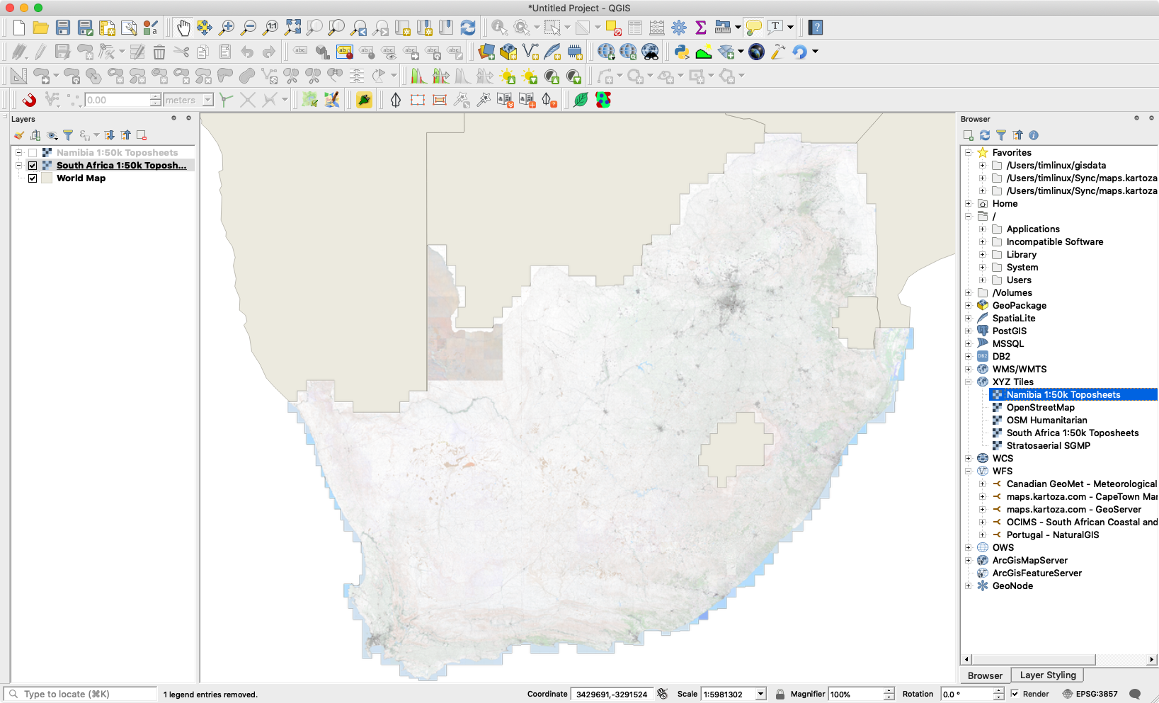
4.) Double click or drag-an-drop the XYZ tile layer into the canvas
5.) You should see a nicely rendered tileset like this:
Useful XYZ tile urls:
- Namibia 1:50 000 toposheets: https://namibia-topo.openstreetmap.org.za/layer/na_sgswa_topo_50k/{z}/{x}/{y}.png
- South Africa 1:50k Toposheets: https://htonl.dev.openstreetmap.org/ngi-tiles/tiles/50k/{z}/{x}/{-y}.png
- South Africa NGI Imagery: http://aerial.openstreetmap.org.za/ngi-aerial/{z}/{x}/{y}.jpg
- Zanzibar Mapping Initiatives: https://tiles.openaerialmap.org/user/5ac4842b26964b0010033104/{z}/{x}/{y}.png
Tim Sutton
Tim started his career by working in Nature Conservation in South Africa. Some years later, around 1998, an opening in the newly formed GIS group in the organisation where he worked presented an opportunity to combine his love of the environment with his enthusiasm for computers. What followed quickly became a deep dive into GIS (including obtaining a Master's Degree in GIS and Environmental Studies) and Open Source. He discovered Linux, also around 1998, and became an ardent fan of using and creating Open Source software. The announcement of the first release of QGIS in 2002 was another key milestone, with Tim quickly becoming deeply involved in the development of QGIS, as well as helping to build the community platforms and governance structures around the project. Formerly the QGIS.org Board Chair, Tim was awarded perpetual Honorary QGIS PSC Member status in 2018 and continues to play an active role in many aspects of the QGIS project. Tim is also engaged in the broader Open Source GIS ecosystem, including having the honour of being an OSGEO Charter Member and promoting the wide array of world-changing Open Source GIS tools provided under the OSGEO umbrella (and beyond) to pretty much anyone who will listen.


No comments yet. Login to start a new discussion Start a new discussion