Blog
Installing QGIS on a Chromebook
Run QGIS on a Chromebook! A high school in Johannesburg shows how to extend Chromebook client notebooks to be effective desktop GIS computers.

QGIS STAC API Plugin
STAC API plugin A new QGIS plugin that allow browsing STAC API catalogs has been release, the plugin developed by Kartoza and sponsored by Microsoft is available for
School GIS Task: Create a 5km COVID-19 Lockdown Exercise Buffer Around Your House
If you are doing some teaching in the classroom and some online and you are finding "blended teaching" overwhelming, this task is designed for asynchronous self study.
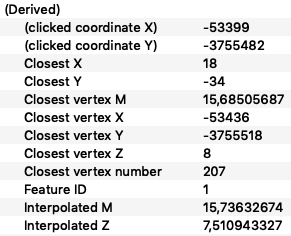
Adding Elevation to a Line from a DEM in PostGIS and Maintaining Accurate Measures
This is the second in a three part series on the behind-the-scenes GIS work that can go into planning a complex event, in this case the Cape Town Marathon.
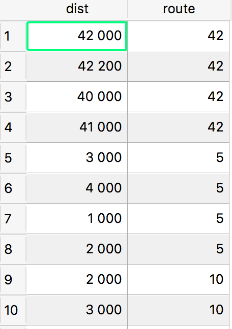
How to Create a Point Distance Marker Layer Along a Line in PostGIS
This is part 1 of a 3-part series.
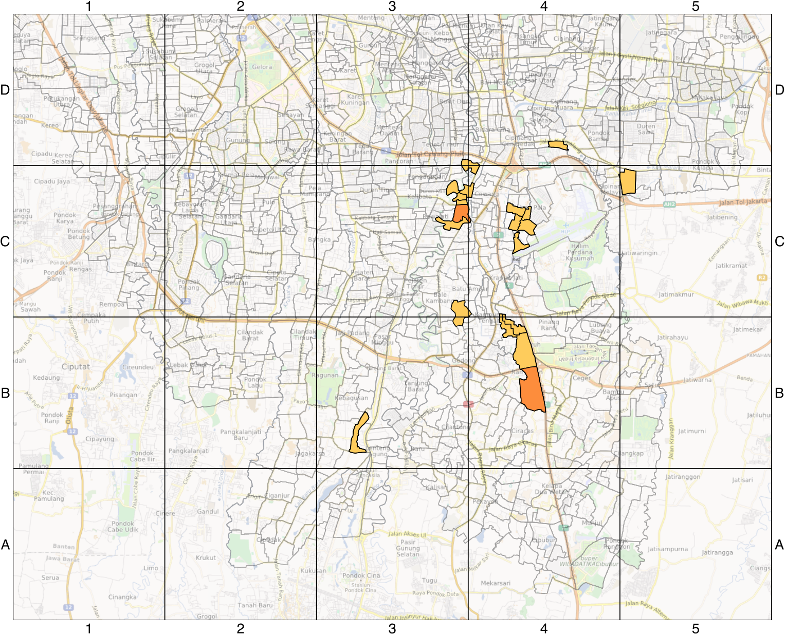
Create a Custom Reference Grid in QGIS Composer
If you need to create a reference grid like this for your map, here's a simple method.
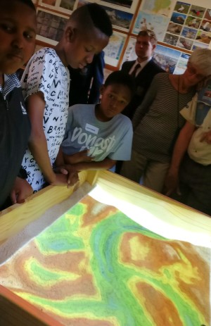
Introducing the First Tangible Landscape in Africa
As part of Kartoza's outreach programme, I recently helped the geography department at St Johns College in Johannesburg set up a Tangible Landscape
Mass reprojection of h5 Files using Gdal and Bash Tricks
I recently got hold of h5 files (Hierarchical Data Format (HDF)) and I tried to load them into QGIS and they were drawing in the wrong places.This was because they were not georeferenced.
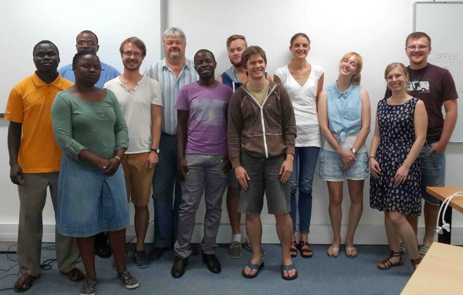
Report Back on the First QGIS User Conference in Nødebo, Denmark
I finally have some time to sit down and write up some thoughts on the QGIS User Conference and Developer Meeting (aka Hackfest) that we just held in Nødebo, Denmark.
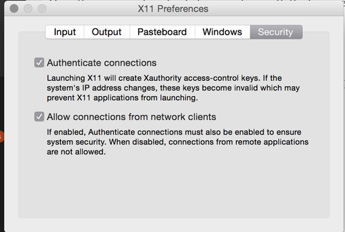
How to Run a Linux GUI Application on OSX Using Docker
Ok so here is the scenario: You just got a nice new MacBook 15" Retina computer thinking it would work as nicely for Linux as your 13" MacBook did and then you discover that the hyb

7 tips for Making Productive use of Docker
I have been using and learning docker since the early days after it was announced.
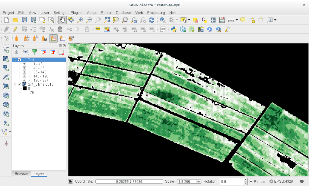
Generating an XYZ ASCII File from a QGIS Raster
Someone wrote to me asking if it would be possible to generate an XYZ ASCII file from a single band raster layer in QGIS.
How To Create a QGIS PDF Report with a Few Lines Of Python
Sometimes you want to automatically generate a report to reflect the latest state of your data.
QGIS Course at AfQUA
Kartoza has just wrapped up a three-day Introduction to QGIS course that we gave pro bono at The African Quaternary: Environments, Ecology and Humans conference in Cape Town
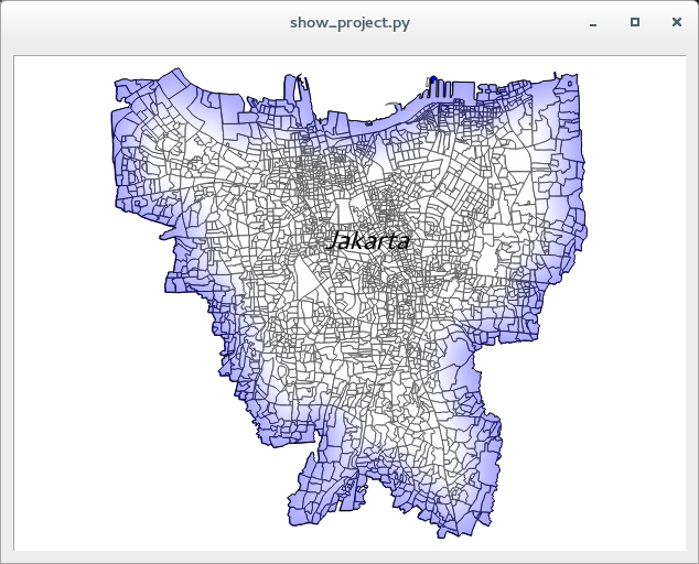
How to Load a QGIS Project in Python
Loading a QGIS project in python
A Quick Hack to Select All Multipart Features in QGIS
A quick hack to select all multipart features in QGIS
Kartoza Docker-helpers for Lazy Sysadmins
Docker is really awesome but typing out all those commands can get tedious.
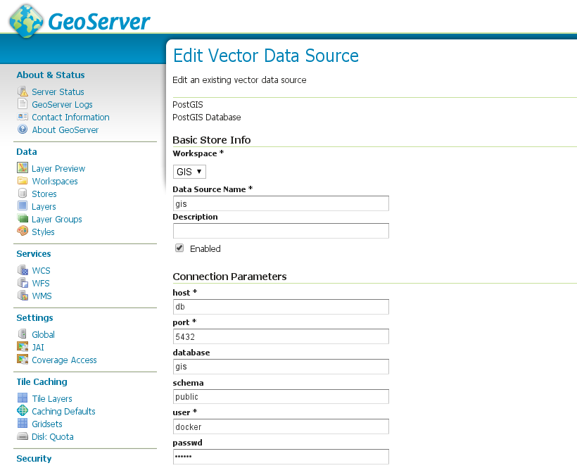
Orchestrating GeoServer with Docker and Fig
In this article I will detail how to set up a simple orchestrated system of docker containers
Setting up a Fedora 21 QGIS Workstation
I have been a long time Ubuntu user (I have actually been using it since Ubuntu 4.10 'Warty Warthog') - the first official release.
Gary Sherman Wins the Sol Katz Award
This year Gary Sherman won the annual Sol Katz award.


